Major Research on Subduction Zone Geological Hazards
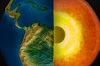
Subduction zones are where one tectonic plate slides beneath another. Produces some of the most devastating seismic, volcanic and landslide hazards on the planet.
A new report offers an ambitious blueprint for understanding subduction zone hazards. It brings together a diverse community of scientists in a long-term collaborative effort to implement new instrumentation at subduction zones. Developing more sophisticated and accurate models.
It has been several years since a report from the Subduction Zones in Four Dimensions Research Coordination Network was produced. After a 2016 workshop created a vision document for the initiative, the National Science Foundation funded the Research Coordination Network to develop a detailed plan. U.S. Through a series of meetings, workshops, webinars and town halls to engage the research community and solicit input, the SZ4D initiative identified community priorities, key infrastructure needs, science activities needed to better understand geohazards and minimize their risks to society.

The implementation plan presented in the new report addresses ongoing discussions with NSF and other agencies regarding funding for the initiative.
Emily Brodsky, professor of Earth and Planetary Sciences at UC Santa Cruz and chair of the SZ4D Steering Committee, says Now is the time to put serious resources into the question of whether or not these events were predictable, and that we are now ready to address.
Subduction zones are found around the world mostly in coastal areas where an oceanic plate dives beneath a continental plate. The resulting geohazards include large earthquakes and tsunamis, active chains of volcanoes, and large landslides. Many large population centers are located along subduction zones and are therefore exposed to these hazards.
The highest risk lies in the United States with the Cascadia subduction zone along the Pacific Northwest coast. Cascadia is not the best place to focus research efforts, according to Brodsky, because it moves so slowly. The Chilean subduction zone is sufficiently geologically active to provide useful information. It is a good locale for comparative studies with Cascadia and Alaska. The SZ4D implementation plan recommends deploying devices at three sites. But 70% of the observational effort in Chile has to do with a substantial portfolio of scientific activities in Cascadia and Alaska. Brodsky explained that what we learned in Chile should be able to translate to Cascadia and Alaska. The initiative has already begun building partnerships with Chilean scientists and international groups studying the subduction zone there, she said.
.jpg "Subduction Zone Geological Hazards")
The plan includes a major effort to systematically improve observations of subduction zones. Collects a variety of measurements across a range of temporal and spatial scales, both on land and under the sea. The infrastructure required for this includes an extensive array of instruments to monitor various aspects of subduction zone behavior as well as subsurface and environmental conditions associated with volcanoes and landslides. In addition the plan calls for researchers to study the geologic context, conduct laboratory experiments, and develop computational models that integrate field observations and laboratory data.
The plan also emphasizes the need for close coordination and deep integration between all components throughout the program. The initiative brings together a diverse community of scientists and stakeholders with broad geological backgrounds and expertise related to earthquakes, volcanoes, and surface processes.
It's a complex problem and solving it requires combining many different parts. It is not enough for individual scientists to focus on their individual pieces, Brodsky says.
Major advances in understanding the science behind subduction zone hazards can provide clear benefits to communities in affected areas, including useful predictions of major earthquakes, volcanic eruptions, and landslides. In Brodsky's words we are not promising that we can predict anything but we must determine whether our inability to predict these things is due to fundamental properties of the system or to our lack of tools. It is said to be the right place at the right time.
George Hilley was the lead editor of the report at Stanford University. The SZ4D initiative is divided into three working groups 1.Landscapes and Seascapes 2.Faulting and Earthquake Cycles 3.Magmatic Drivers of Eruption and two integrative groups 1.Building Equity and Capacity in Geoscience 2.Modeling Collaborative for Subduction with a total of 74 members. 55 universities. Seismic Wave
Story Source:
Materials provided by University of California, Santa Cruz.
Note: Content may be changed for vogue and length.


0 Comments